
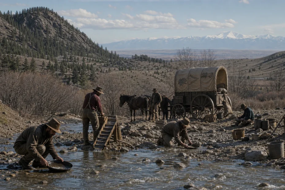
See where the Pikes Peak Gold Rush actually happened, why “Pikes Peak or Bust” spread, how Denver and Central City grew, and what the rush changed.
- “Pikes Peak” named a broad destination; the first important finds were near present-day Denver and in Front Range districts farther north.
- The 1858 discoveries drew the 1859 Fifty-Niners, but many left after shallow placers failed to match the publicity.
- The durable legacy was not only gold: Denver became a supply center, lode towns grew, and settlement intensified pressure on Cheyenne and Arapaho lands.

- Goldfields were concentrated around Cherry Creek, the South Platte and Front Range districts—not on Pikes Peak.
- The 1859 migrants became known as Fifty-Niners.
- Weak early placers caused many to turn back; richer lodes near Central City sustained mining.
- Denver’s supply and transport role proved more durable than many individual claims.
- The rush reshaped Indigenous land relations and helped drive creation of Colorado Territory in 1861.
The famous mountain was a signpost, not the mine
Pikes Peak dominates the Front Range skyline, so it gave eastern travelers a memorable name for the destination. Newspapers, guidebooks and painted wagon covers turned that name into a regional brand. But the practical route to understanding the rush runs through Cherry Creek, the South Platte, Idaho Springs, Gregory Gulch, Central City and Black Hawk.
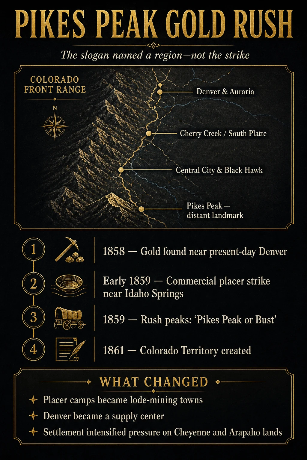
Where the Pikes Peak Gold Rush actually happened
Early 1858 discoveries were reported near the confluence of Cherry Creek and the South Platte River, where Denver and Auraria soon developed. George A. Jackson found commercially significant placer gold near present-day Idaho Springs in January 1859. John H. Gregory’s discovery in May 1859 helped establish the lode district around Gregory Gulch, Central City and Black Hawk.
Pikes Peak lies well south of these principal early fields. Its national visibility made it a useful geographic shorthand. The Library of Congress notes that the mountain’s name became a byword for Colorado during the rush. That is different from saying prospectors found the defining 1859 deposits on the peak.
A practical 1858–61 timeline
| Period | Development | Decision consequence |
|---|---|---|
| Summer 1858 | Small finds near Cherry Creek and the South Platte create new publicity. | Town promoters and prospectors begin building a destination story before the field is proven at scale. |
| Early 1859 | Jackson’s placer find near Idaho Springs demonstrates commercial-grade ground. | Reports give incoming migrants a stronger reason to continue into the mountains. |
| Spring–summer 1859 | The Fifty-Niner migration peaks; Gregory Gulch and nearby lodes attract attention. | Mining shifts from shallow washing toward veins that require shafts, ore treatment and capital. |
| 1859–60 | Many newcomers find crowded or disappointing ground and return east. | “Go-backers” expose the gap between migration publicity and individual mining odds. |
| 1861 | Colorado Territory is organized. | Rush settlement becomes a durable political and commercial transformation. |
Why so many people went—and why many left
The California rush had already created a cultural template: a reported strike could be converted into migration before geology, access or claim availability was clear. The slogan reduced a complex decision to a binary promise—reach the mountain or fail. Low travel barriers relative to California also made the central Rockies seem attainable.
On arrival, migrants faced a harsher filter. Shallow placers were patchy and quickly occupied. Spring runoff, cold, altitude, food cost, animal loss and limited mining skill eroded small budgets. A miner who had enough funds to reach Colorado did not necessarily have enough to prospect for months or buy into a lode claim. Many returned, while others moved into trade, transport, building or wage work.
Placer excitement became a lode-mining economy
Placer gold is already liberated from rock and naturally concentrated in gravel. A pan can test it, and a sluice can increase throughput. Lode gold remains in mineralized veins, so miners must locate, break, hoist and process rock. The USGS history of the Central City district describes the district as the Front Range’s leading mining camp and records production beginning in 1859.
This transition changed who could compete. An individual could test a bar with hand tools; a deep mine required timber, explosives, pumping, hoisting, milling, skilled labor and sustained finance. The resulting towns—Central City, Black Hawk and Idaho Springs—were not simply larger versions of a placer camp. They were industrial systems.
Denver’s durable advantage
A mining town depends on supplies. Denver’s position at the plains-to-mountains transition allowed it to serve freight, lodging, food, tools, information and finance. Even when individual claims disappointed, the flow of people and goods created urban demand. This is a recurring rush pattern: the most stable wealth often accumulates around infrastructure rather than the most publicized prospector.
Compare that pattern with gold-rush towns, the California Gold Rush and the Black Hills Gold Rush. In each case, the supply network outlived many individual digging sites.
Settlement had a land cost
The Front Range was not an empty stage. Cheyenne and Arapaho peoples held treaty-recognized relationships and use rights in the region. The National Park Service’s road-to-Sand-Creek history describes most new arrivals as squatters on Cheyenne and Arapaho lands and connects the 1859 influx to the coercive 1861 Fort Wise Treaty and rising conflict.
This consequence is not a detached later chapter. The gold rush expanded the settler population that demanded farms, roads, townsites and political control. A complete account must therefore separate what migrants believed they were doing from the land and sovereignty effects their migration produced.
How to read a Pikes Peak Gold Rush claim
- Locate the event on a map before accepting the Pikes Peak label literally.
- Separate the 1858 Denver-area reports, Jackson’s 1859 placer and Gregory’s lode discovery.
- Ask whether a migrant estimate counts departures, arrivals, summer peak or permanent settlers.
- Distinguish placer recovery from later lode production.
- Check whether economic claims include Denver services as well as mines.
- Look for Cheyenne and Arapaho land context rather than an “empty frontier” narrative.
GoldConsul’s claim-staking guide, mining-method overview and gold-rush era guide provide the legal and technical background needed to compare accounts.
Video context: A visual overview of the Colorado rush and the shift from placers to mountain districts
Knowledge Gap and Editorial Perspective
Contemporary migrant counts vary widely because “went to Pikes Peak,” “crossed the plains,” “arrived in the district” and “remained in Colorado” are different populations. A dramatic round number without a method should be treated as an indicator of scale, not an audited census.
The misconception about Pikes Peak is useful: it reveals how marketing compresses geography. The correct map then explains the real economics—Denver as gateway, creek placers as test ground and Central City as the lode-mining center.
Bottom Line
The Pikes Peak Gold Rush was a Colorado regional rush whose most important early finds lay around Denver and in northern Front Range districts. It created disappointed returnees, durable mining towns, a powerful supply city and accelerating pressure on Indigenous lands.
FAQ: Pikes Peak Gold Rush
When was the Pikes Peak Gold Rush?
It began with 1858 discoveries, peaked with the 1859 Fifty-Niner migration and transitioned into a more established mining and territorial economy by 1861.
Was gold found on Pikes Peak?
Small occurrences exist in the broader region, but the defining early rush deposits were near present-day Denver, Idaho Springs, Gregory Gulch, Central City and Black Hawk—not on Pikes Peak itself.
What did “Pikes Peak or Bust” mean?
It was a migration slogan that used the famous mountain as a symbol for the Colorado goldfields. “Bust” acknowledged the real chance of failure.
Who were the Fifty-Niners?
They were the gold seekers who traveled to the Colorado fields in 1859, a decade after the California Forty-Niners.
How did the rush affect Native peoples?
The influx expanded settlement on Cheyenne and Arapaho lands, increased pressure for land cessions and contributed to the chain of conflict and coercive policy that followed.
Sources and verification
The dates, physical values and evidence boundaries in this guide are based on the following primary or specialist sources.
- USGS — Central City district geology — Official geology and mining history of the leading Front Range district.
- USGS — Geology and Ore Deposits of the Front Range — Records the January 1859 commercial placer discovery near Idaho Springs and the rush.
- NPS — The Road to Sand Creek — Connects the 1859 influx with settlement on Cheyenne and Arapaho lands.
- Library of Congress — Pikes Peak Summit — Explains Pikes Peak as a byword for Colorado rather than the specific goldfield.
- Library of Congress — The Rush for Gold — Primary-image context for an 1859 Pikes Peak journey.
- NPS — Rocky Mountain National Park history — Federal history noting the 1859 gold rush.
- Daily Dose Documentary — Colorado Gold Rush — Long-form visual overview of the Colorado rush.
 When you purchase a service or a product through our links, we sometimes earn a commission, at no extra cost to you.