Plan legal Nevada gold prospecting: verify land status, active claims, access, permitted methods and field safety before visiting a district.
- Verify land status, mineral entry, and active claims for the exact parcel
- Match your tools and disturbance to current land-manager requirements
- Treat historic districts as research leads—not access permission
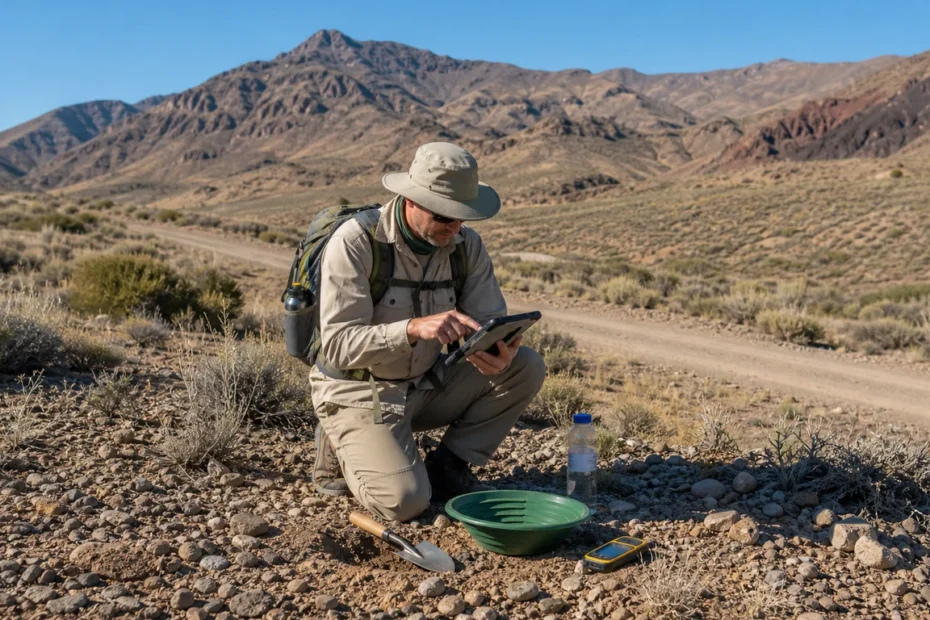
Recreational prospecting in Nevada can be lawful only after you verify land status, existing mining claims, local restrictions, access, and the disturbance your method will cause. A historic gold district is a research lead—not permission to enter, dig, or recover minerals.
- Check the land manager and current land status before checking geology.
- Search BLM’s Mineral & Land Records System, then confirm details with the relevant office.
- Do not enter active mine sites, private property, closed roads, or another party’s claim without permission.
- Hand tools can still cause regulated disturbance in sensitive locations.
- Historic districts guide research; they do not guarantee access or recoverable gold today.
Nevada is a world-scale gold producer and a tempting destination for prospectors. The same mineral history that creates opportunity also creates complexity: the state contains dense claim coverage, private and public land, active operations, withdrawn areas, seasonal road hazards, and rules that change with the land manager and proposed activity.
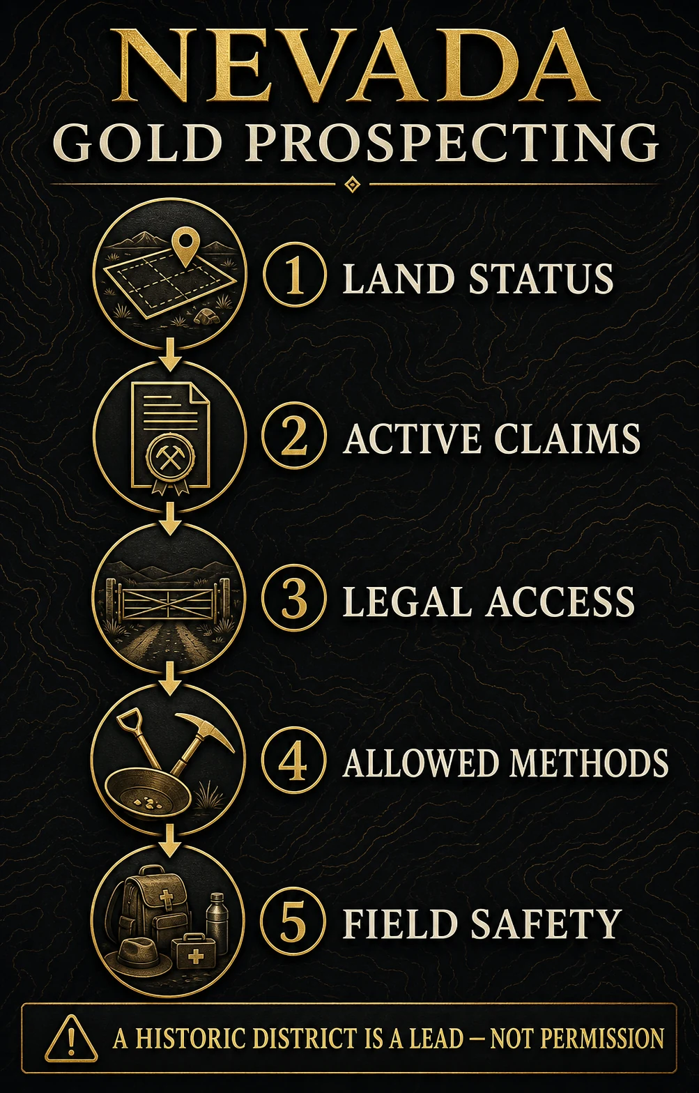
The practical objective is not to find a “best spot” from a blog. It is to build a defensible trip plan that passes five gates before a shovel touches the ground.
Why Nevada requires a claim-first mindset
The Bureau of Land Management’s Nevada minerals overview reports more than 270,000 active mining claims in the state—about 47% of the BLM total. That density makes assumptions dangerous. Empty-looking desert can be private land, withdrawn land, or part of an active claim.
BLM also points operators to the federal surface-management rules in 43 CFR 3809. The level of notice, plan, bonding, or review depends on the activity and expected disturbance. Recreational intent does not automatically exempt ground disturbance.
“Public land” does not mean “open to mineral entry,” and “open to mineral entry” does not mean “unclaimed.” Confirm both questions independently.
The five-gate workflow before you prospect
Gate 1: Land manager
Identify whether the parcel is managed by BLM, the U.S. Forest Service, a state agency, a county, a tribe, or a private owner.
Gate 2: Mineral status
Determine whether the land is open to mineral entry or withdrawn by law, designation, reservation, or site-specific order.
Gate 3: Claims and ownership
Search current federal records and obtain permission where a valid claim or private mineral interest applies.
Gate 4: Method and disturbance
Describe the tools, excavation, water use, vehicle access, sampling, and rehabilitation your plan requires.
Gate 5: Access and field safety
Verify roads, closures, weather, communications, water, heat exposure, and a check-in plan.
If any gate is unresolved, pause. A promising geology layer does not cure a land-status or permission problem.
How to check land and claim status
- Mark a specific area. Save coordinates and identify the township, range, and section where possible. A district name is too broad.
- Identify the surface manager. Use current agency maps, not only a commercial recreation map or old guidebook.
- Check whether the land is open. BLM’s claim-location guidance notes that not all public lands are open to mineral entry and lists categories of withdrawn land.
- Search the Mineral & Land Records System. Use MLRS for claim and land-record research. Save the query date and relevant serial numbers.
- Read the record details. Map symbols alone can be incomplete or misread. Check claim status, commodity, location description, and case information.
- Confirm with the responsible office. Records and map layers can lag filings or require interpretation. Contact the BLM field office or other land manager before travel.
- Carry evidence and permissions. Save maps offline and bring written authorization where access depends on a claimant or owner.
MLRS is a research tool, not a legal opinion or a guarantee that every boundary is field-marked. If the stakes are meaningful, consult the responsible agency or a Nevada professional qualified to interpret land and mineral rights.
What “casual use” does—and does not—mean
BLM rules distinguish activities by their expected surface impact. Small-scale hand sampling may fall within casual-use concepts in some settings, while mechanized equipment, road creation, significant excavation, suction dredging, processing, or repeated disturbance can trigger additional review.
| Proposed activity | Questions to resolve | Why it matters |
|---|---|---|
| Walking, visual inspection, hand lens | Is entry lawful and is the area closed or restricted? | Even non-disturbing access can be prohibited on private, active, or closed land |
| Hand panning or small hand sampling | Is water use allowed? Is the location claimed or environmentally restricted? | Method and location determine whether the activity is acceptable |
| Metal detecting | Are mineral, archaeological, cultural, or recreation rules applicable? | Artifacts and cultural resources are not treated like ordinary mineral finds |
| Drywashing or powered equipment | Does the land manager require notice, plan, permit, or bonding? | Mechanization and disturbed area can change the regulatory category |
| Vehicle travel off established routes | Is the route open and is cross-country travel permitted? | Road and travel-management violations are separate from mining rights |
This table is a screening aid, not a permit determination. Ask the land manager about your exact tools, location, dates, and anticipated disturbance.
Historic placer districts: research leads, not open-site recommendations
The U.S. Geological Survey’s Placer Gold Deposits of Nevada compiles historic production and occurrence information. The report is valuable for understanding where placer activity was recorded, but it predates modern claim databases, current access rules, and decades of additional work.
| Historic district or area | Research value | What to verify now |
|---|---|---|
| Battle Mountain area | Long mineral history and multiple placer references | Dense current claims, mine boundaries, road access, land status |
| Manhattan and Round Mountain areas | Historic placer and lode context | Active operations, private interests, claim status, closures |
| Osceola district | Well-known historic placer record | Current ownership, claims, route conditions, seasonal access |
| Silver City area | Comstock-region mining context and reported placers | Private parcels, cultural resources, municipal and local restrictions |
| Spring Valley and Sierra districts | Historic occurrence evidence for desktop study | Exact parcel, land manager, claims, and modern field conditions |
Do not treat the names above as coordinates or invitations. Use them to begin literature research, then repeat the five-gate workflow for a specific parcel. The same discipline applies to guides for Montana, Idaho, Texas, and Pennsylvania.
Build a realistic field plan
Desktop pack
- Current land-status map
- MLRS query and serial numbers
- Agency contacts
- Offline route and backup route
Safety pack
- More water than the planned day requires
- Sun, heat, and cold protection
- First aid and communication backup
- Recovery gear and spare tire
Low-impact tools
- Hand lens and magnet
- Sample bags and labels
- Small hand tools only if authorized
- Brush and materials for rehabilitation
Nevada’s remoteness turns small mistakes into large problems. Tell someone where you are going and when to escalate if you miss check-in. Do not rely on mobile service, and avoid entering adits, shafts, highwalls, or active mine infrastructure.
Set realistic recovery expectations
Historic production does not imply that a casual visitor will recover payable gold. Accessible ground may have been worked repeatedly, and fine Nevada placer gold can require careful sampling and recovery. The meaningful output from a first trip may be a documented negative sample that helps eliminate ground.
A disciplined sampling log records coordinates, land-status check, sediment setting, sample volume, method, concentrates, and result. Without consistent sample size and method, comparing “color” from two sites tells you little.
If you do recover natural gold, preserve the location documentation without trespassing or disclosing sensitive sites. The guide to selling natural gold nuggets explains why specimen character, provenance, and buyer channel can matter in addition to melt value.
Trip go/no-go checklist
- I identified the surface and mineral estate manager for the exact parcel.
- I checked whether the land is open to mineral entry and searched current claims.
- I obtained any required owner, claimant, agency, or access permission in writing.
- I described my method and confirmed whether it is allowed without additional authorization.
- I checked current road, fire, weather, and seasonal restrictions.
- I have offline navigation, water, recovery equipment, and a check-in plan.
- I will fill disturbances, remove waste, and leave cultural or archaeological material untouched.
If you cannot check every item, the responsible decision is “no-go” until the gap is resolved. For method selection after legal access is confirmed, review gold mining and prospecting methods.
The best Nevada prospecting advice is not a secret coordinate. It is a repeatable process that prevents a geology lead from becoming a trespass, claim conflict, damaged site, or desert emergency.
Online records, historic reports, and map layers can be incomplete, delayed, or hard to reconcile in the field. Only the relevant land manager, claimant or owner, and—where necessary—a qualified professional can resolve site-specific authority.
Video: using BLM’s digital mining records
This BLM National video introduces digital mining-record workflows. Interface details can change, so use it alongside the current MLRS site and agency guidance.
Bottom line
Nevada offers exceptional gold geology and unusually dense claim activity. Start with the exact parcel, verify the land manager, mineral status and claims, confirm that your method is authorized, and build a conservative safety plan. Historic districts can focus research, but they never replace current permission.
Frequently asked questions about gold mining in Nevada
Can I pan for gold anywhere on BLM land in Nevada?
No. You must confirm that the specific land is open to mineral entry, not subject to a conflicting claim or restriction, accessible lawfully, and suitable for the proposed activity.
How do I find active mining claims in Nevada?
Search BLM’s Mineral & Land Records System using the best available location information, read the case details, save the query date, and confirm uncertainties with the responsible BLM office.
Does a mining claim mean I cannot cross the land?
Claim rights, surface access, roads, and public passage can be fact-specific. Do not disturb claimed minerals or interfere with operations; ask the claimant and land manager when access is uncertain.
Are historic Nevada placer districts still productive?
Some may still contain gold, but historic production does not establish current access, claim availability, economic grade, or likely recreational recovery. Use historic records only as a research starting point.
Do I need a permit to use a drywasher or powered equipment?
Potentially. The answer depends on land status, equipment, disturbed area, duration, and agency rules. Describe the exact activity to the land manager before operating.
 When you purchase a service or a product through our links, we sometimes earn a commission, at no extra cost to you.